
News you can use
News you can use
Above-normal temperatures could continue through winter
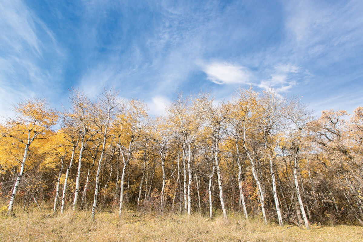
Aspen tress line the side of Beaver Creek Highway south of Havre Wednesday, as unseasonably warm weather moves in for the weekend forecast. Average temperature highs for this time of year hover around 59 degrees, while our weekend forecast calls for temperatures in the lower 70s.
After a steady shower with a spectacular lightning show soaked the region Wednesday evening and this morning, the area is expected to return to unseasonably mild temperatures this weekend and early next week, a trend that could continue through the winter.
A prediction released today by The Weather Channel and National Weather Service forecast that temperatures in North-central Montana are likely to be above the norm through the winter months.
And the weather is expected to turn warmer again after a short dip in temperatures expected today and Friday, following the precipitation in the last 24 hours.
The storm last night dropped .3 inches of rain in Havre, with the low reported at 47 following a high of 72.
National Weather Service predicted a high for Havre today of a much-cooler 57 and Friday of 61, but then the thermometer is expected to creep back up to the upper 60s, with 70s in the forecast for Saturday and Monday. No more rain is predicted in the Weather Service forecast and the lows are expected to remain in the 40s.
Those temperatures continue to buck the norm for north-central Montana, although they are nowhere near records. The average high and low for Oct. 15 in Havre are 59 and 31, compared to the 72 and 47 this year, but the record high - set in 1961 - is 85 degrees fahrenheit while the record low of 10 degrees was set in 1899.
Weather Service predicts high temperatures will drop back closer to normal by the middle of next week, with a high of 63 predicted for Wednesday, the last day in its forecast published today.
Weather Channel goes a bit further out, both with its prediction and its forecast of warm temperatures. Its 10-day forecast calls for highs in the 70s Saturday through Tuesday, with a drop to 64 predicted for Wednesday but back up to 68 next Thursday, 70 Friday, Oct. 24, and 66 Saturday, Oct. 25.
And as winter draws nearer, predictions of what the weather is likely to be are saying warmer and dryer than normal.
Weather Channel today released its prediction of winter weather, with the forecast expecting warmer-than-normal temperatures in Montana, especially in November and January.
The channel's forecasters predict a weak to moderate El Niño - warmer than normal temperatures on the equatorial Pacific Ocean - to develop, which often leads to warmer temperatures and below-normal snowfall in this part of Montana, although they also warn that many events can lead to variations on that.
Even if the warmer, drier winter occurs, that also doesn't guarantee north-central Montana won't see 40-below-zero temperatures or storms dropping several feet of snow. The prediction covers the average temperatures, while day-to-day events can be quite different.
The forecast from the National Weather Service's parent organization, the National Atmospheric and Oceanographic Administration, also continues to contrast with the popular forecasts from Farmers' Almanac and Old Farmer's Almanac.
Old Farmer's Almanac predicts a slightly colder and slightly drier than normal winter in this region, while the Farmers' Almanac calls for "frigid and flaky" conditions.
But NOAA says otherwise. Its long-range forecast, updated today, calls for above-average temperatures for most of Montana from November through March and average to below-average precipitation through that period, with the dry weather focusing on the western half of the state in many of those months.


Reader Comments(0)