
News you can use
News you can use
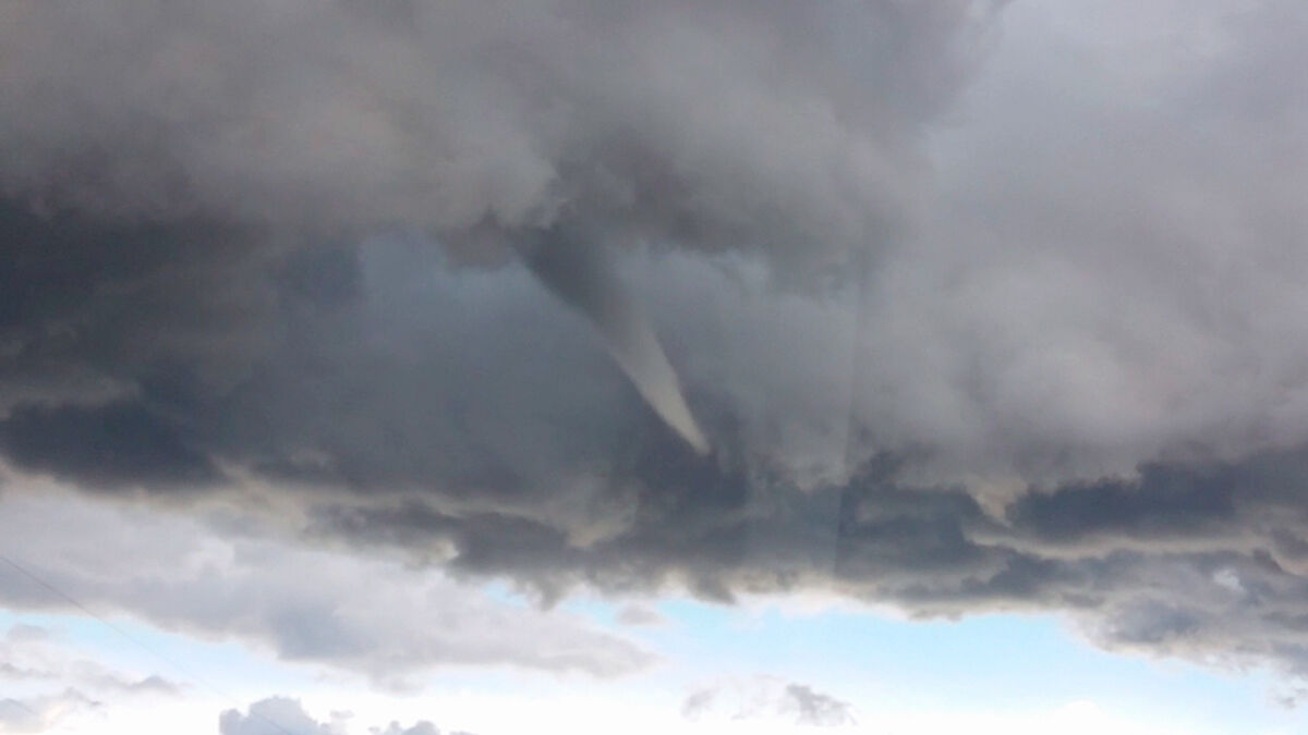
Courtesy photo from video/Josh Miller A funnel cloud hangs in the air about 4:30 p.m. Tuesday near Havre. Trained storm spotter Josh Miller spotted and tracked the funnel cloud, broadcasting the information to National Weather Service.
Havre Daily News Staff
The Havre area had a near miss with a tornado Tuesday, with trained weather spotter Josh Miller spotting a funnel cloud about 4:30 p.m. while he was tracking a storm.
"I stopped at Mile Marker 102 on (U.S.) Highway 87 to get the initial pictures," Miller emailed the Havre Daily News. "That's when I realized the storm was really firing up. I turned around back towards Havre and proceeded north. There was some strong motion within the storm, and eventually it produced a funnel cloud that lasted about five to ten minutes."
National Weather Service meteorologist Cody Moldan said this morning that if the funnel had touched the ground, it would have been a tornado, but what is classified as a cold-weather tornado which is relatively weak.
Those tornadoes can spawn winds up to about 70 mph that can toss around lawn chairs and do damage to trees and fences, but, Moldan said, would not create the damage a supercell tornado can.
Miller said the storm did not produce other funnel clouds, but "continued to have strong motion, with strong winds, torrential rain, small hail, and deadly lightning. This was a rapidly developing storm."
Moldan said no major tornadoes have hit the Havre area recently, although a weak tornado touched down in Blaine County in 2014 and tornadoes were spotted in Hill County in 1980 and 1986, and most recently on June 16, 1995.
Moldan said that although being close to the Bear Paw Mountains makes it harder for tornadoes to form that farther away from the mountains, but it certainly can happen.
"You guys are still fairly favorable are for tornadoes," he said.
Watch Miller's video of the funnel cloud on his or the Havre Daily News' Facebook page.

Reader Comments(0)